
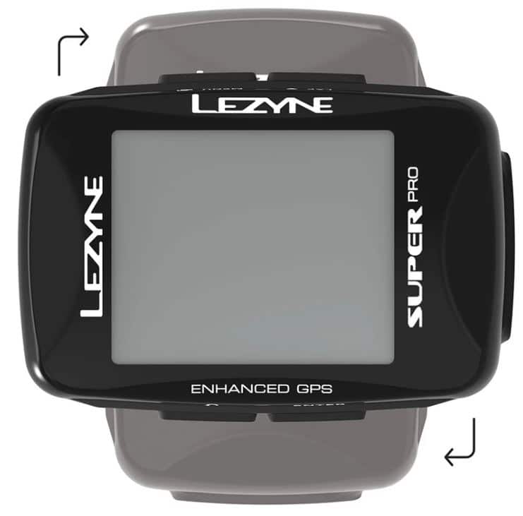
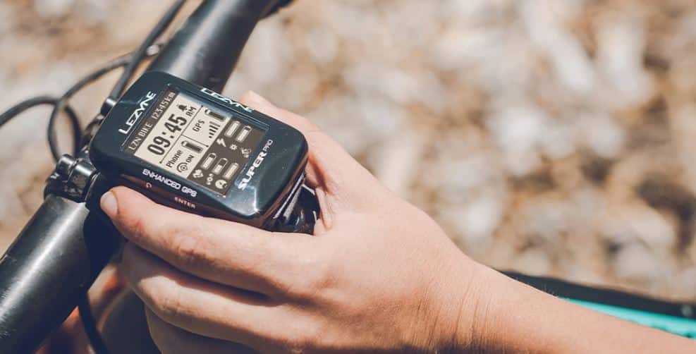
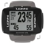


The completely redesigned Super Pro GPS is an excellent choice for riders looking for a complete, mid-size device. The new design gives the device an improved appearance. On top of that, it can be rotated horizontally for a landscape view. The screen has improved resolution and contrast and now has a map page for a much better navigation experience. The device’s firmware has been updated to show more data fields and can now be paired with the “Smart Connect” LED system. The USB port has been upgraded and is much more water resistant.
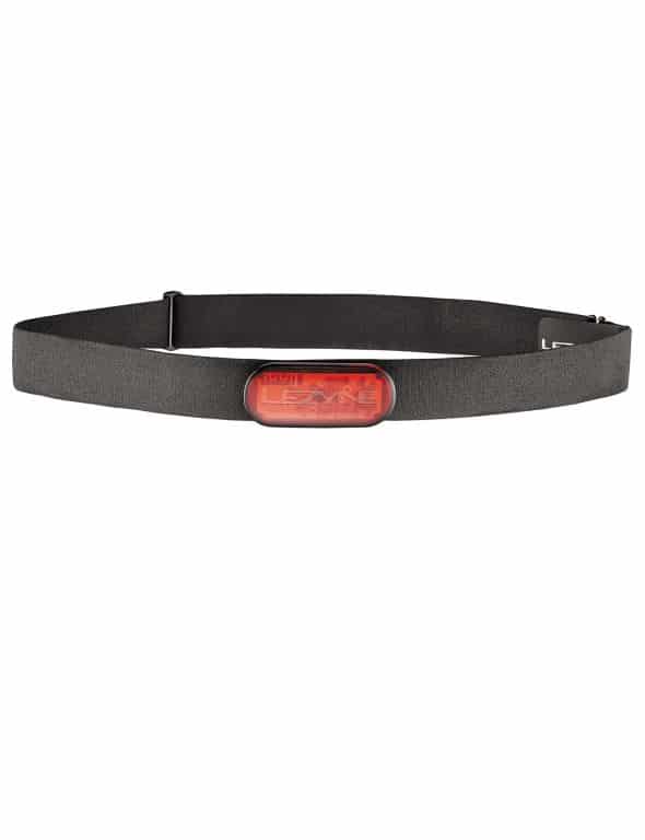
The Super GPS Pro connects with both Bluetooth and ANT+ and can be connected to energy meters, heart rate sensors, speed and/or cadence sensors, smart trainers and wireless drivetrains. The device features a GPS/Glonass chipset, integrated barometer and accelerometer for superior data capture and altitude measurements. The GPS offers up to 28 hours of battery life.
In combination with the Lezyne Ally phone app, the following functions can be activated:
- Full navigation capabilities
- Telephone notifications
- Lezyne Track (live tracking)
- Strava Live segments
- Training integration
- Device customization
Features
- Super accurate navigation, thanks to the use of GPS and Glonass satellites
- Simultaneous ANT+ and Bluetooth Smart connection possible
- Multiple real-time functions in conjunction with the Lezyne Ally app
- Equipped with barometer and accelerometer
- Easy setup via the Lezyne Ally phone app
- Imports .txc and gpx. files
- Equipped with trainer mode
- Multiple bike profiles
- Custom route construction
- Intuitive four-button operation
- Lithium-polymer battery provides up to 28 hours of runtime
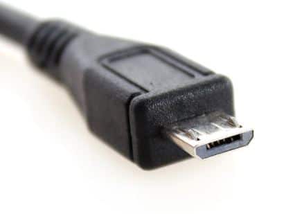
- Micro USB rechargeable
- Stores up to 400 hours of trip data
- Customizable fields and number of pages (up to 8 fields)
- Preloaded maps on screen
- Custom notifications and automatic presets
- Extremely weatherproof
- Includes X-Lock standard mounting
Specifications
Weight: 60 grams
Runtime: 28 hours
Memory: 400 hours
Dimensions: GPS 70.6mm (W) x 48.16mm (L) x 26.0mm (H)
Screen: 32.6mm (W) x 39.8mm (L)
Connections
- New: FE-C Trainer compatibility
- New: compatible with Smart Connect
- Receives SMS, e-mail, phone call and message app notifications when paired with smartphone
- Syncs rides via bluetooth Smart with the Lezyne Ally phone app
- Instant download of trip files (.fit) via plug-and-play flash drive technology and upload directly to GPS Root website for trip analysis
- Automatically syncing with Strava, TrainingPeaks and Today’s Plan
- Bluetooth Smart or ANT+ allows connection to heart rate monitors, cadence/speed sensors and energy meters.
- Turn-by-turn navigation
- Offline maps and route modification
- Tracking Steva segments and routes with stars
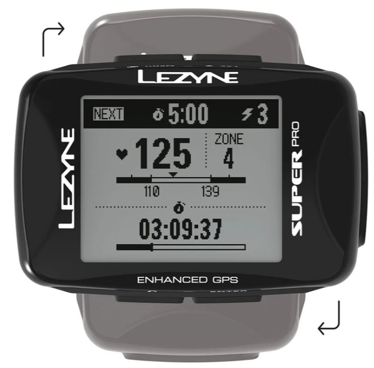
- Following structured workouts from Today’s Plan and TrainingPeaks
Lezyne GPS Smart Connect
The GPS Ally app is more than just an app; it is the core of the interactive GPS platform. The app provides the user with a host of functions readily available through the Bluetooth Smart connection. Program and control your GPS device quickly and easily from your phone with the Ally app.
Rides can be uploaded wirelessly and automatically synced with well-known, popular apps such as Strava, Today’s Plan and TrainingPeaks. By enabling notifications, you can receive phone notifications, text messages and emails, among other things.
Load Strava Live Segments to track PRs or Q/KOMs in real time. Take advantage of mapped opportunities for route mapping or open a saved route to get instant step-by-step instructions. Upload and save a map to experience offline maps, navigation and re-routing if you lose a phone signal. Enable the Lezyne Track-tracking feature so friends and family can follow your ride in real time.
OFFLINE NAVIGATION AND MAPS
Always driving without getting lost has never been easier. You can create your own route using waypoints, searching for an address or tapping on a destination with the Ally app. The app also offers unique offline navigation capabilities. With an online connection to the Ally app, you easily download a map of your desired region. Once it is saved, you can continue building routes. Even with offline maps, you can create a route using waypoints, searching for an address or just tapping on a destination. You will then be given a direct step-by-step navigation.
If asked for user manuals, please refer to the tutorials at the top of the page (found with the product images).
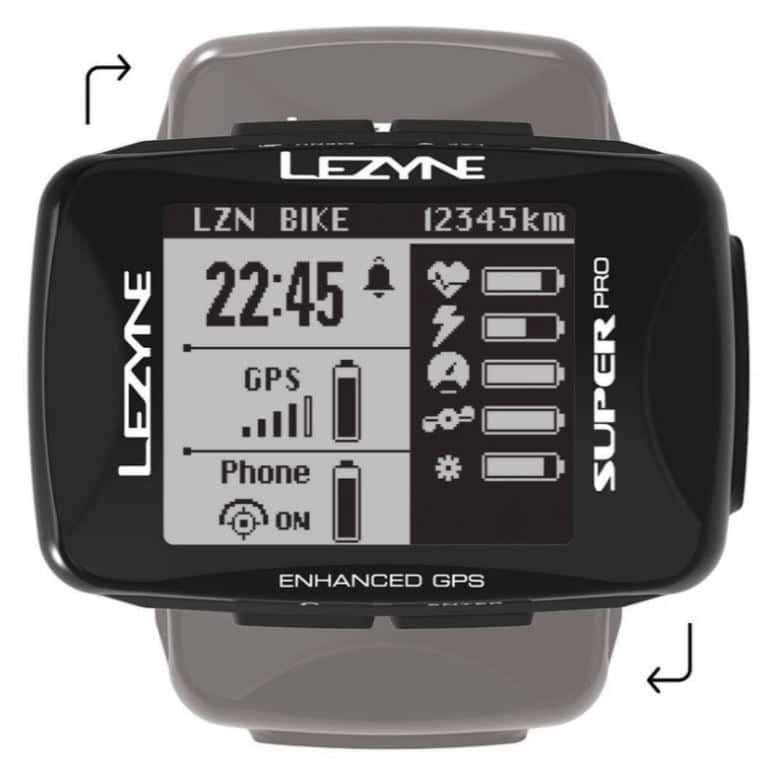
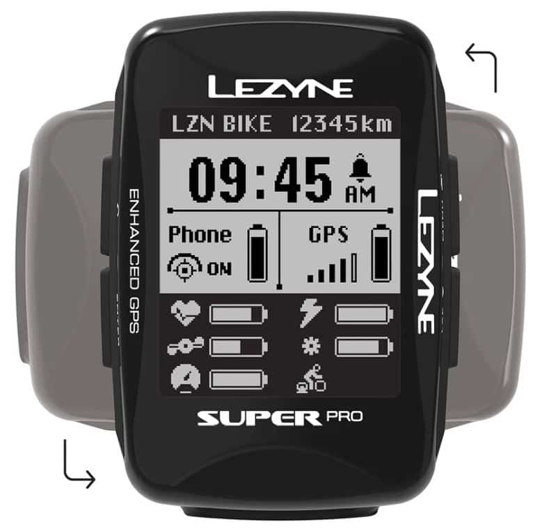
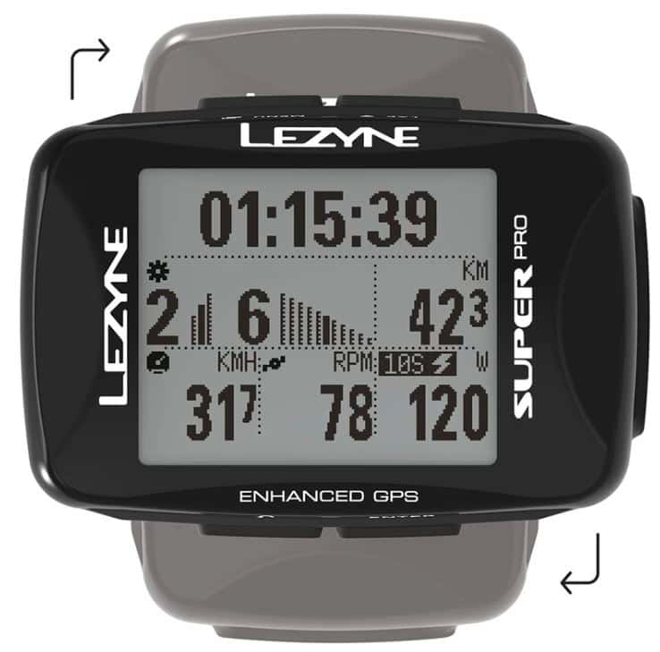
Display
- Map
- Turn-by-turn navigation
- Live tracking icon
- Strava Life segments
- Heart rate (current, average, max)
- Cadence (current, average)
- Power (6 data display options)
- Fields for specific training: TSS®, NP®, IF®
- Electric powertrain data
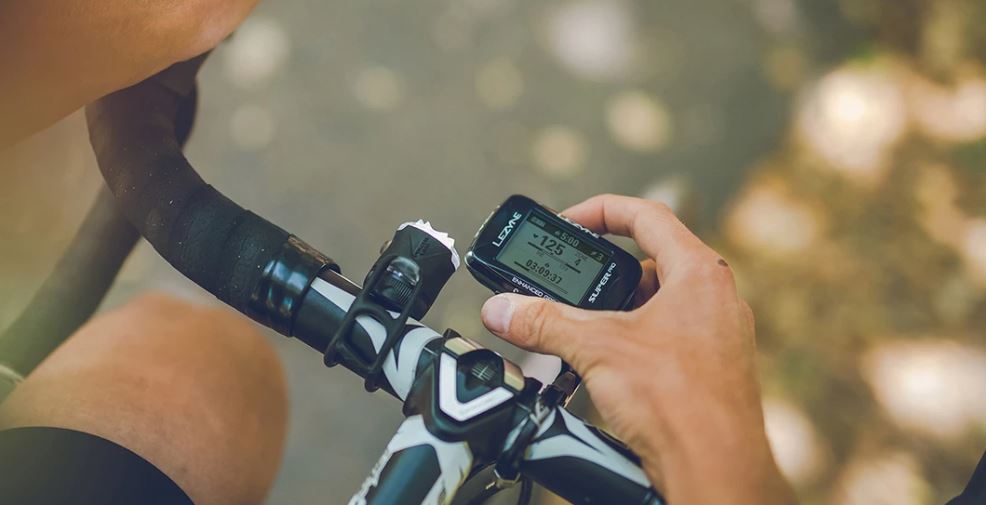
- Speed (current, average, max.)
- Distance
- Odometer
- Time (driving time, clock)
- Date
- Laps and rounds averages
- Altitude (rise, fall)
- Slope degree
- Calories
- Temperature
- GPS signal strength
- Battery life device and connected devices
- Icons connected devices
- Breadcrumb trail page
Click here for the manual for the Super Pro GPS
Create your own and bike route? Click here for a clear and concise guide
Click here for the guide to using offline maps and navigation


Reviews
There are no reviews yet